IGEO Conseils carries out surveys of buildings, making use of the latest state of the art 3D equipment. We deliver our clients :
TOPOGRAPHY
2D and 3D surveys- Facade plans at scales 1/100 and 1/50,
- Floor plans,
- Sections,
- Georeferenced Point clouds.
Our strong experience of 3D scanner equipment allows us to issue state of the art client deliverables.
The 3D scanner used by IGEO Conseils is able to capture up to one million points per second but also high-definition photos.
By moving our 3D scan on site around several locations, we are able to collect details of the entire building and to derive plans with a remarkable accuracy
IGEO Conseils is also working with Archeologists in order to help them to capture 3D scenes accurately whenever there is requirement for high precision.
We also carry out surveys of stone quarries and landfills from which we derive volumes calculations and Digital Terrain Models.


Do you need an expert surveyor for your project ?

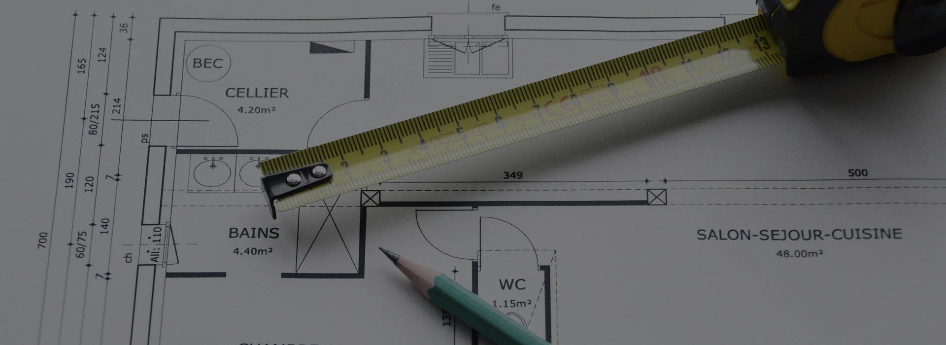
Floor plans
A floor plan is normally using a scale of 1/100 or 1/50, depending on the requested level of detail. Those maps issued from a 3D laser scanner survey or from more conventionnal survey techniques, allow to define accurately dimensions for all building elements but also rooms surfaces.
Those plans are usually requested for sale or for renting condominimum’s lots in order to derive the so-called « loi CARREZ » but also for building refurbishing.
IGEO Conseils guarantees collected data and calculated areas accuracy.
Section drawings
IGEO Conseils can establish section drawings of a building for a better understanding of its physical layout.
Deliverables are usually available at scale 1/20 or 1/50, depending on client’s request.


Facade plans
Whenever there is a need for combining elegance and accuracy, IGEO Conseils has the necessary skills to deliver facade plans, making use of state of the art techniques, whether it is for refurbishing or construction projects.

Do you need an expert surveyor for your project ?
Roof plans
For refurbishing projects or structure inspections, we carry out roof surveys by ensuring the latest regulations and safety protocols.


Plot plans
Plot plans are top views of the terrain which are often required when requesting a building permit.
They usually specify the area for construction and bring information on the terrain topography, used by the architect.
A good undertanding of the topographic terrain features allows a proper site preparation for construction projects.
Long and section profiles
Long profiles or section profiles can either refer to natural terrain or to the project. Usually, they combine both in order to foresee the best project compatibility with its surroundings.
Those profiles are usually requested for building permits or road projects.
IGEO Conseils know-how will help you to better define your project with regards to its surroundings.
